Crossflatts is a small village on the Leeds and Liverpool Canal close to Bingley; largely residential, it boasts a pub, but few historic buildings besides a former mill. The walk also passes through the edge of the village of Riddlesden, as well as through the villages of East Morton and Micklethwaite. Micklethwaite was originally an agricultural hamlet mentioned in the Domesday Book as Muceltu(o)it; it has no church or public house, but boasts some fine seventeenth century buildings, including the former Grange.
Crossflatts Railway Station was opened on the Airedale Line in 1982 and was the only one of the stations on the line opened in that decade to be built on a completely new site, rather than on the site of a previously closed station. Unsurprisingly, it is therefore a simple two platform affair with no station buildings besides the typical modern waiting shelters. From the station, we turn right along Keighley Road, shortly passing the Royal public house on the right. Continue to follow the road, then just after the second junction with The Crescent on the right, bear right along a footpath signposted to Crossflatts Surgery and follow this as it bends left to cross Morton Beck and end at Ryshworth Crescent. Turn right and follow this until it crosses Morton Swing Bridge No. 198A over the Leeds and Liverpool Canal.
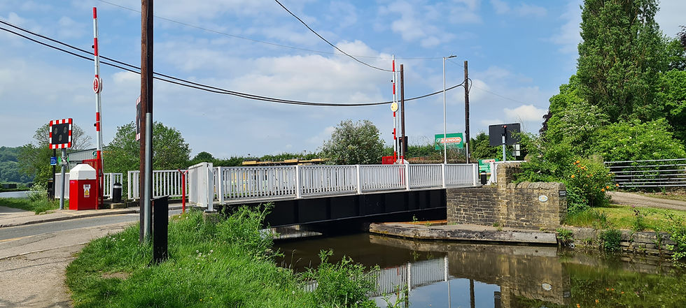
Morton Swing Bridge No. 198A
Take a short detour to the right along the towpath to see the modest aqueduct over Morton Beck; otherwise, turn left and follow the towpath along the canal for one and a half miles, passing under Swine Lane Bridge No. 198 (and the adjacent Bridge No. 197B, a modern footbridge), crossing another aqueduct over How Beck, and eventually reaching Granby Swing Bridge No. 197A. Here, we leave the towpath and cross the canal via the swing bridge, passing the Marquis of Granby public house on the right and continuing straight ahead up Granby Lane until it ends at a junction. Here, turn right along Southfield Avenue and then immediately left to follow a cobbled footpath that runs steeply uphill to Barley Cote Avenue. Cross straight over and follow another path to Barley Cote Road, crossing straight over once more and following another path that shortly climbs stone steps and bends sharp right.
Follow the footpath behind a row of houses, after which it runs straight ahead across the edge of seven fields, before curving left to reach the hamlet of West Morton. The footpath is halfway up a hillside and offers fine views of the surrounding area. Follow the footpath (which is waymarked) past several cottages and former farm buildings, eventually climbing over a stile, following the path along four more field edges, and reaching the end of Bury Lane. Bear right, still following a waymarked public footpath, which runs downhill between fields. Shortly, the path bends left, then right; here, turn left through a metal gate and follow a path across more fields, eventually reaching Street Lane.
Turn right and follow Street Lane as it enters the village of East Morton, and eventually ends at Main Road. Turn left and then right at a small roundabout along Morton Lane, then immediately turn left and follow a narrow lane past the Church of St. Luke (consecrated in 1851) on the right, shortly passing the former Vicarage (also on the right) to enter an open space. Turn left at the next junction, passing Morton Village Institute on the right to return to Main Road. Turn right and follow this past the Busfeild Arms public house (which isn’t misspelt – it is named after the local Busfeild family who lived in Morton during the nineteenth century), then take the fourth right turn along Little Lane. Follow this as it becomes a path running downhill to Cliffe Mill Fold. Here, we turn left and then immediately right along a footpath that runs alongside Morton Beck.
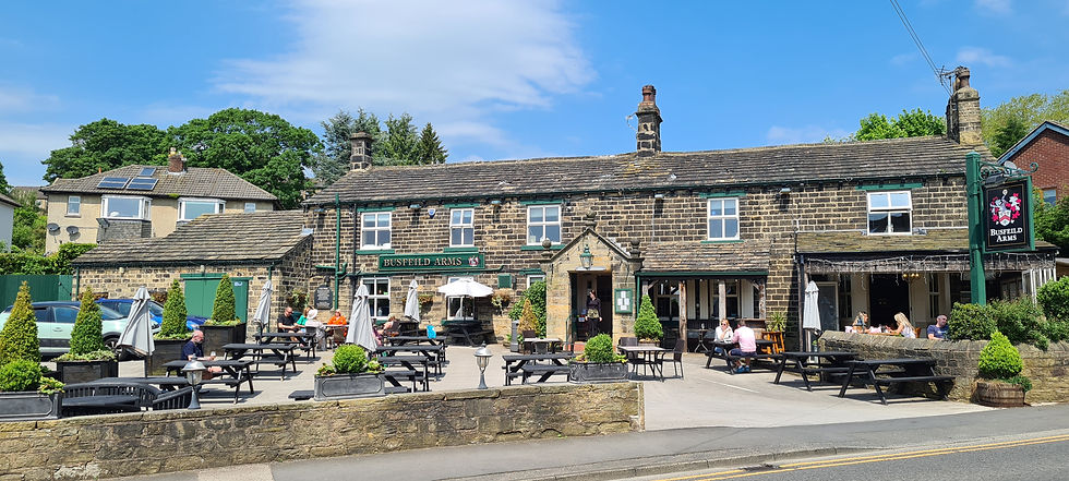
The Busfeild Arms
When the path crosses a bridge over the beck, ignore a path over a stone stile on the right and continue straight ahead, eventually joining the end of Beck Road. Follow this until it ends at Micklethwaite Lane, passing the former Methodist Free Church on the right, which was built in 1875. Turn right and follow the lane downhill through the rather charming centre of Micklethwaite, passing the village green with its Maypole on the right. Eventually, the lane passes Airedale Mills (now converted into accommodation) and reaches Micklethwaite Swing Bridge No. 199 over the Leeds and Liverpool Canal. Here, we cross the bridge and turn left to briefly follow the towpath once again, passing moorings and a winding hole on the opposite bank, and shortly reaching A.B.C. Swing Footbridge. Here, turn right and leave the towpath along Canal Road, immediately turning left along Newark Road. Follow this as it bends right and at a crossroads continue straight ahead along Preston Terrace, which very soon bends right and becomes Ivy Mews. Follow this until it ends, then continue straight ahead through a metal gate to reach Keighley Road and, finally, turn left to return to the railway station.
From Crossflatts we continue to our penultimate station along the Airedale line as we visit the market town of Keighley, located in the heart of “Brontë country”…
Comments